Ground
Satellite or flat colour
Same area, one switch: favour speed or favour looks.
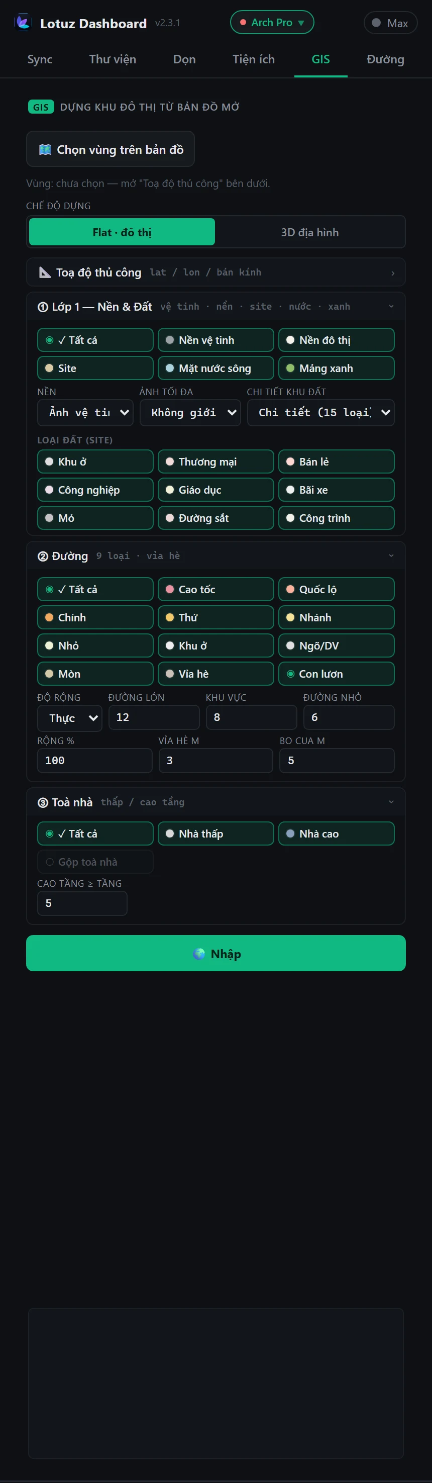
Frame an area on the map and get building blocks, roads at real widths, green areas and terrain — each layer on its own tag.
Each plugin is bought separately, by the year. Sign in with the account you bought it on to unlock it.
Requires: SketchUp 2021.1+ · Windows
Satellite ground, blocks, roads and green areas — each on its own tag.
Same area, one switch: favour speed or favour looks.
Split from OSM tags, each with its own colour and tag.
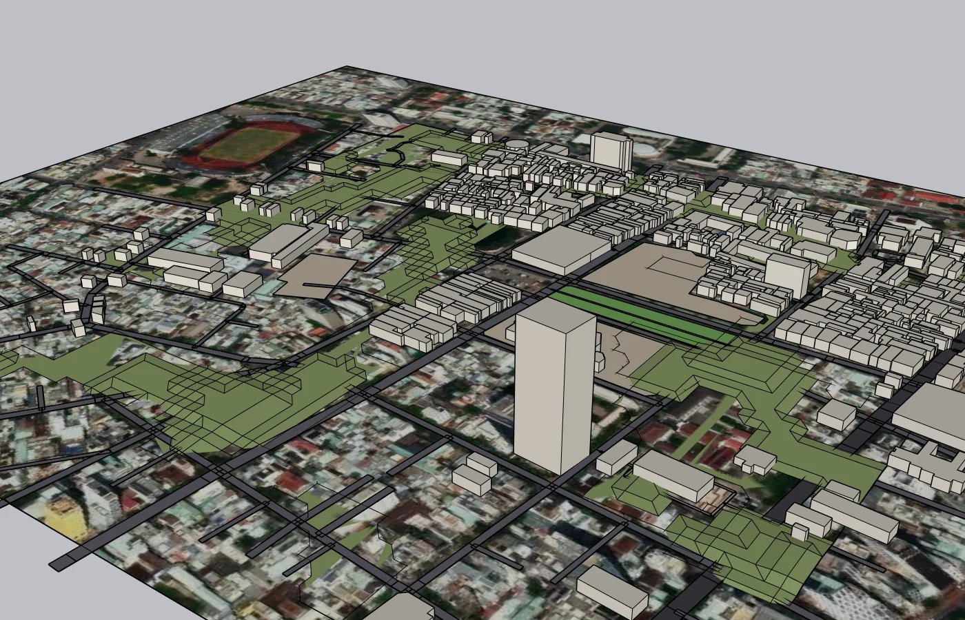
Imported with Lotuz GIS
Reads OSM width and lane tags, with sidewalks and medians.
Nine-metre threshold; merge or keep separate as you prefer.
Same area, one switch: favour speed or favour looks.
Split from OSM tags, each with its own colour and tag.
Reads OSM width and lane tags, with sidewalks and medians.
Nine-metre threshold; merge or keep separate as you prefer.
No mock marketing UI — real SketchUp / 3ds Max / Photoshop panels from Lotuz workflows.
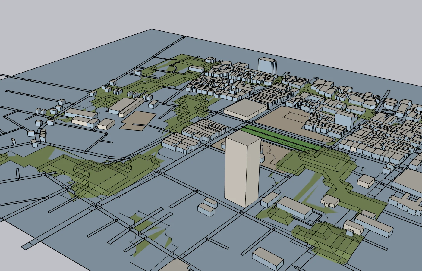
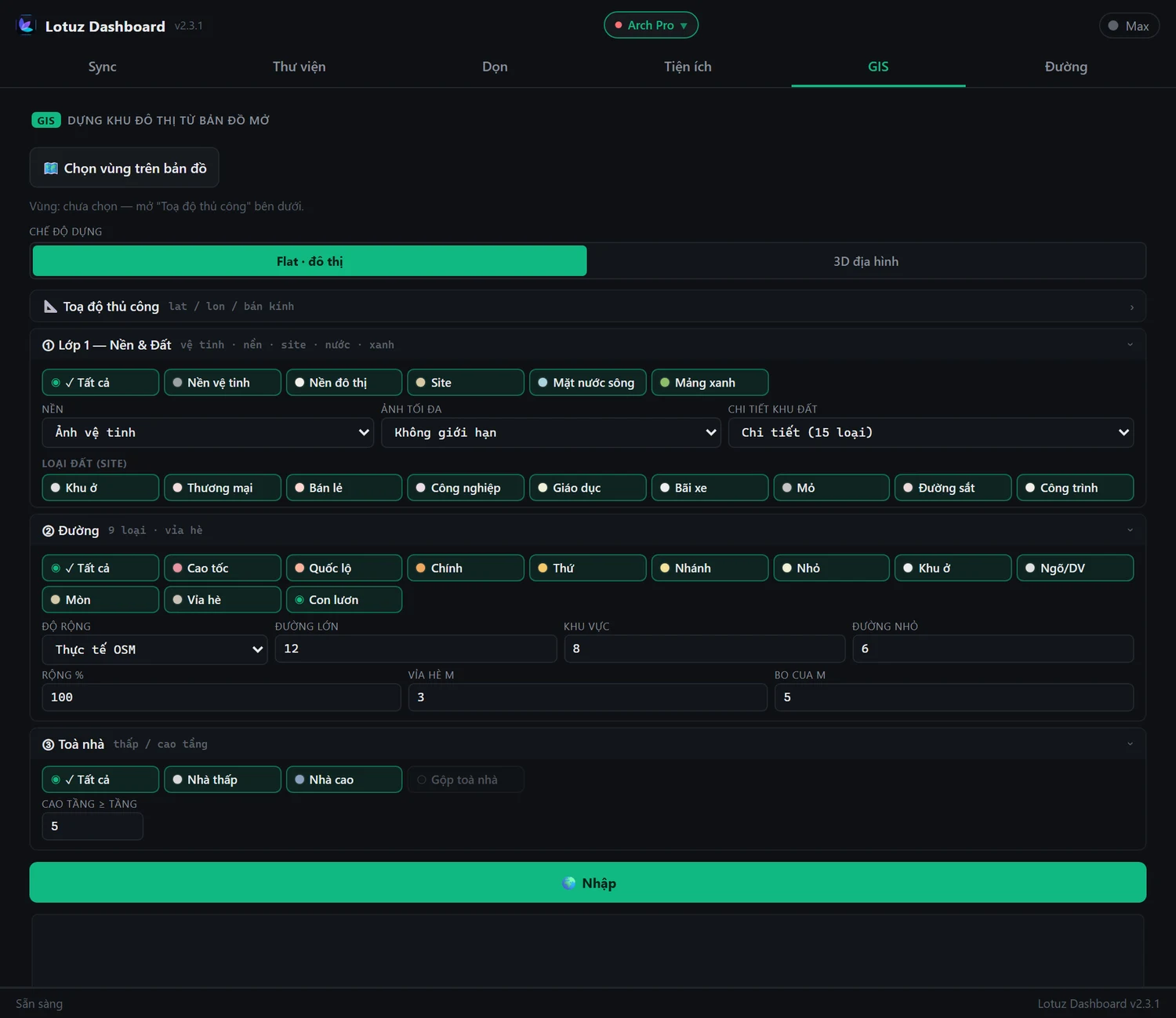
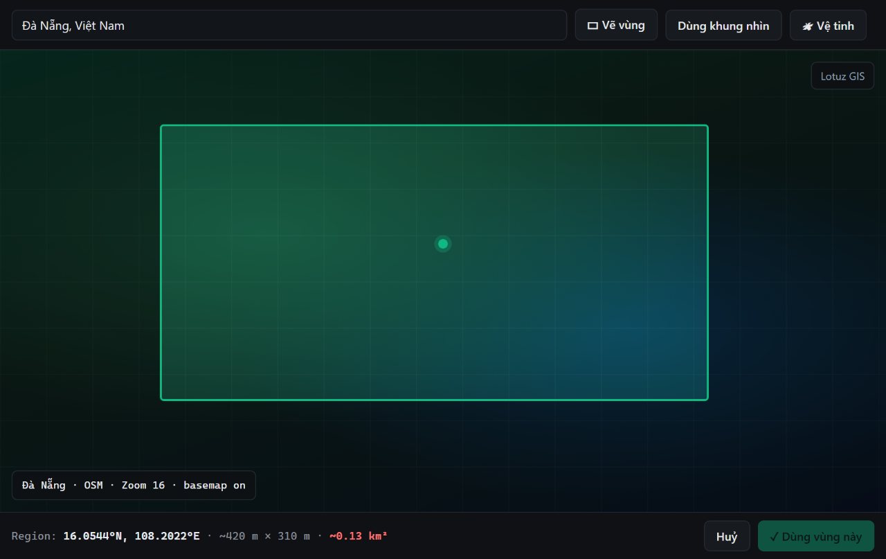
You need the blocks, roads and parcels around the site to place a proposal in its real context, instead of modelling boxes by hand off a satellite image.
Build the context in one sitting: satellite ground, green areas, water, low and tall buildings already separated so you can toggle them while presenting.
The model carries real coordinates, so shadows follow the actual latitude and longitude. Sections through terrain come from elevation data rather than guesswork.
Read a site quickly: roads by class, land by function, each on its own tag.
Open the map and drag a rectangle around the site — or type latitude, longitude and a radius if you already have coordinates.
Flat for urban studies, or 3D terrain when the slope actually matters.
Three blocks: ground and land, roads, buildings. Switch off what you will not use and the model stays light.
The job runs in the background with a live log, and can be cancelled if you framed the wrong area.
Every layer arrives as its own tagged group. Hide what is in the way, bring it back for the presentation, and push it on to 3ds Max with Lotuz Sync if you need to.
Geometry comes from OpenStreetMap via Overpass; the backdrop is ESRI’s satellite imagery layer; elevation is decoded from Terrarium terrain tiles using (R×256 + G + B/256) − 32768.
Three levels of detail: two coarse groups, fifteen types from OSM tags, or one multi-coloured surface per group when you only need the big picture. Nine functional groups toggle independently: residential, commercial, retail, industrial, education, parking, quarry, railway and civic.
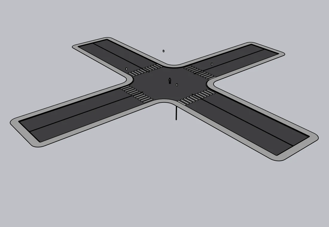
Nine road classes from motorway to track. “Real OSM” mode reads the width and lane tags where they exist; only untagged roads fall back to the three widths you set. Sidewalks follow the selected roads, and dual carriageways get a median.
The threshold defaults to nine metres, and buildings with no height data go in the low group. Merge each group into a single block to keep the model light, or keep them separate when you need to edit.
Over a large area, unlimited satellite imagery can reach tens of megabytes for nothing. Caps of 2000, 4000 and 8000 px are built in, or switch to flat colour when all you need is massing.
The model records the areas you have brought in. Pick an overlapping one and you are warned, instead of quietly stacking two copies of the same context.
Geometry from OpenStreetMap, imagery from ESRI’s satellite layer, elevation from open terrain tiles. It is open data; how detailed it gets depends on OSM coverage where you are working.
Major cities have solid road and building coverage. Rural areas are sparser on building footprints — still enough for massing and site reading, but do not expect every house.
Cancel while it is running. If it already finished, each layer is its own group, so deleting the right groups clears it.
No. GIS is sold separately by the year; nothing is metered per use.
The site plus one or two surrounding blocks covers most projects. Anything larger is slow and loads the model with geometry you will not use.
Yes — it is ordinary SketchUp geometry, not locked objects. Edit, delete and paint it like any other group.
Each plugin is bought separately, by the year. Sign in with the account you bought it on to unlock it.
No map account, no API key, no per-request fee.
Click on the map, or type the site latitude / longitude.
300–500 m is usually enough for one building. Expand later if needed.
The plugin fetches data and builds layered massing.
Layer names ready to toggle for presentations — not one fused blob.
Map-based massing; height from recorded storeys when available.
Major and minor axes, sidewalks and curbs as separate types.
Parks, residential, commercial — classified from source data.
Real elevation for slopes, or flat ground when you do not need it.
Real basemap with selectable resolution to control file weight.
Lat/long on the model so sun shadows match the site.
The same site can be rough massing for a camera view, or detailed for documentation.
Dense city cores are usually complete; suburbs may lack buildings or heights. The plugin builds what the map has — it does not invent.
If storeys are not recorded, the plugin estimates. Verify when you need drawing accuracy.
Start at 300–500 m. Multi-kilometre areas are slow and bog SketchUp down.
Data from OpenStreetMap (ODbL) — include “© OpenStreetMap contributors” when you publish images.
Hands-on tutorials written by the Lotuz team for architects and visualizers — free to read, no account needed. (In Vietnamese.)
Courses:SketchUpCorona · 3ds MaxD5 RenderBlenderBrowse the whole Community →
AI for Photoshop
Generate, relight and upscale with AI without leaving your open document. 17 models, 118 architecture prompts.
Learn more →Render and edit architectural images on the web
Upload a SketchUp view, pick a preset and press Render — the result keeps your massing and camera. Not happy with one spot? Mark it to change, add or remove, and nothing else moves.
Learn more →SketchUp to 3ds Max sync
Native geometry transfer between apps — no FBX, no axis flips, no broken texture paths.
Learn more →SketchUp to Blender — early build
Live link from SketchUp to Blender, carrying materials, camera and sun direction. Install the add-on for Blender 4.2 or newer and enable it in Preferences › Add-ons. Early build, still being finished.
Learn more →Roads, junctions and markings in SketchUp
Draw an alignment and build the carriageway to one of fifteen standard sections, with curb-return junctions, QCVN 41:2019 markings and terrain following.
Learn more →Lay curbs and edging along a path
Pick a profile and run it along a path: curbs, planter edging, gutters. A library of ready-made profiles is included.
Learn more →Parametric doors, windows and curtain walls
Build doors, windows and curtain walls from parameters inside SketchUp, in the Doors / Curtain wall tab of the Lotuz Dashboard.
Learn more →Clean up SketchUp files — free
Eleven controlled cleaning commands, each undoable on its own. Find the heavy objects, merge duplicates without changing shapes, then write a compacted copy.
Learn more →SKP · SKM · texture library
Browse models, materials and textures in one window. Thumbnails are packed into the folder itself, so the whole studio shares them.
Learn more →Massing and apartment layout — free
Block out a building, split a typical floor into apartments and read planning figures right inside SketchUp. Free, no expiry.
Learn more →Block · Remove · Manage · Add SketchUp plugins
One place to control extensions: toggle, block conflicts, uninstall broken plugins, install more, and review hotfixes — free with Lotuz.
Learn more →Use Claude with SketchUp
Let Claude or Codex drive SketchUp over the MCP protocol. Still being finished, opening soon.
Learn more →