Sections
Fifteen ready sections
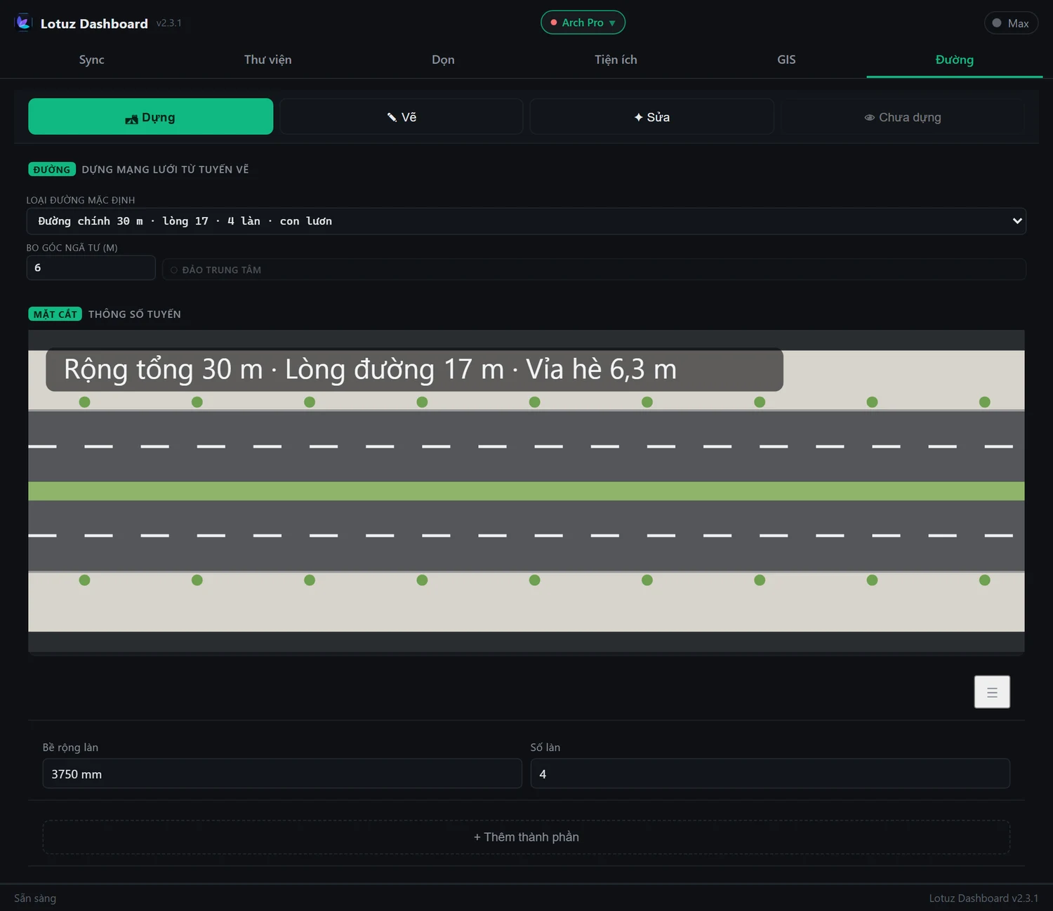
Reserve widths from 11.9 m to 45.4 m, previewed in the panel.
Draw an alignment and build the carriageway to one of fifteen standard sections, with curb-return junctions, QCVN 41:2019 markings and terrain following.
Each plugin is bought separately, by the year. Sign in with the account you bought it on to unlock it.
Requires: SketchUp 2025+ · Windows
Built from the alignment you draw, to standard sections and Vietnamese marking rules.
Reserve widths from 11.9 m to 45.4 m, previewed in the panel.
Centre line from lane count, 40 cm stop bar, arrows per available turn.
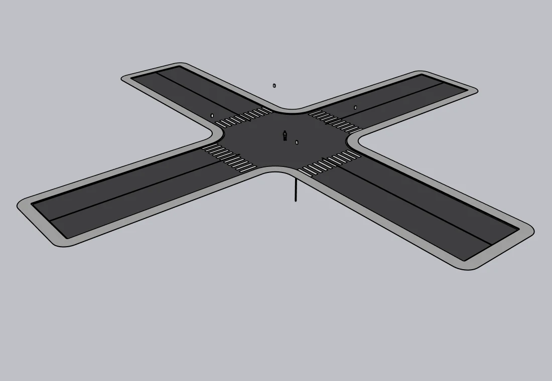
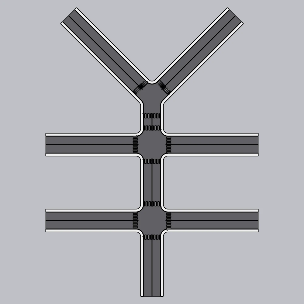
A junction built with Lotuz Road
Individual curb returns, crossings, optional central island.
Ray-cast elevation, draped surfaces, embankments to the toe.
Reserve widths from 11.9 m to 45.4 m, previewed in the panel.
Centre line from lane count, 40 cm stop bar, arrows per available turn.
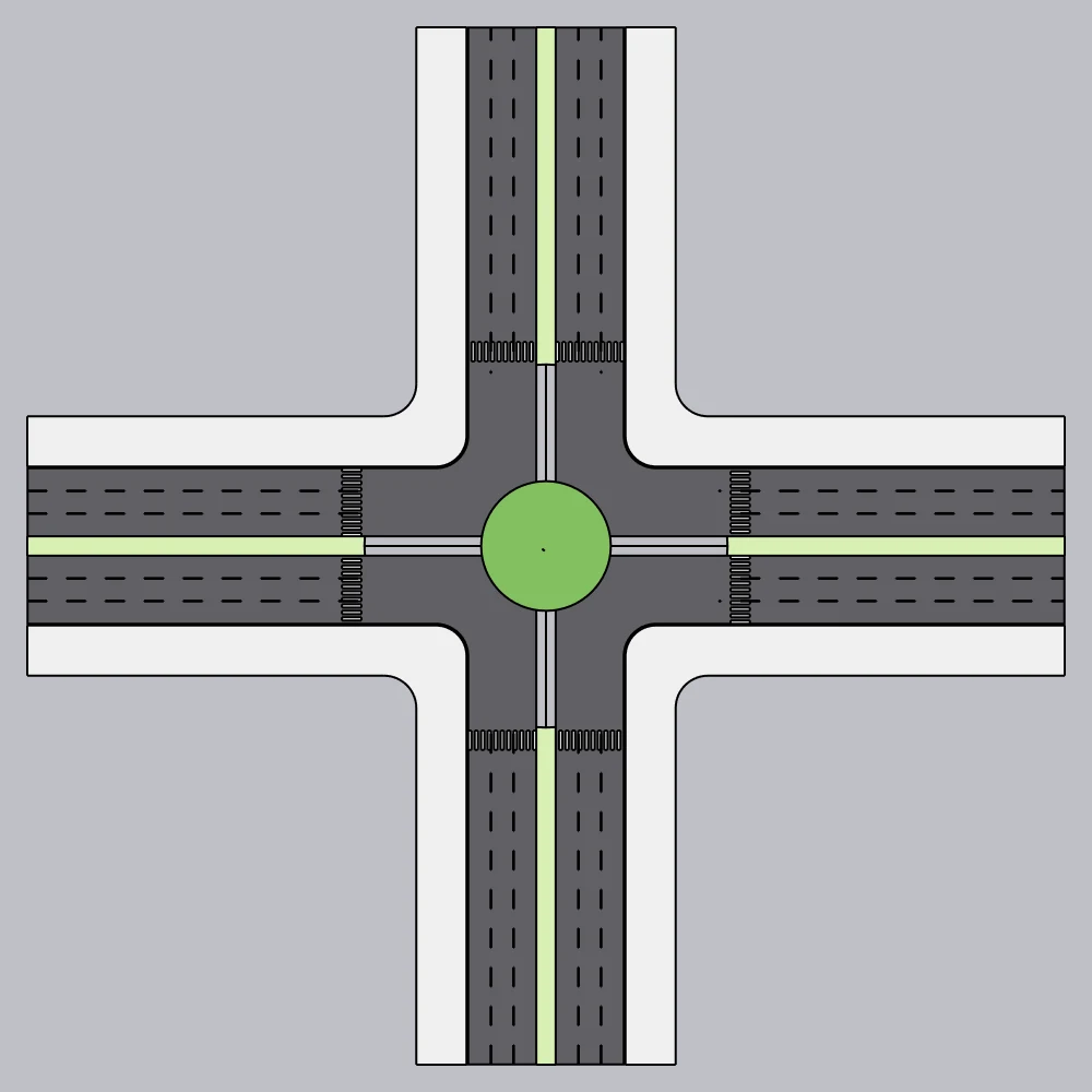
Individual curb returns, crossings, optional central island.
Ray-cast elevation, draped surfaces, embankments to the toe.
No mock marketing UI — real SketchUp / 3ds Max / Photoshop panels from Lotuz workflows.
A road network in a scheme needs the right reserve width, the right carriageway, sidewalks and junctions — not grey strips stretched roughly into place.
The alignment follows terrain already in your model, embankments run from the road edge down to the ground, and the land inside the corridor is patched without touching the original terrain mesh.
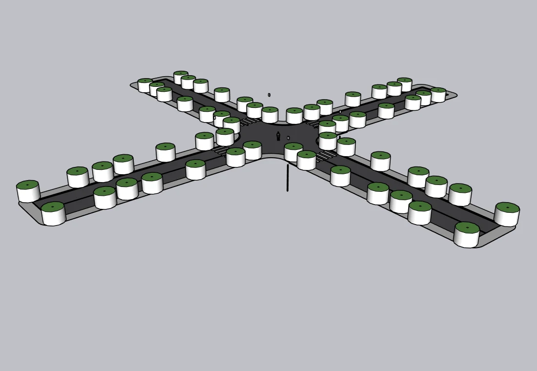
Lane markings, arrows, crossings and street trees are all generated — the view down the street reads as a street, not an empty plane.
Import the context with GIS, then draw the designed alignment over it. Same model, same plan.
An alignment is just edges in SketchUp. Draw new ones from the tab, or reuse the roads you imported with GIS.
Fifteen ready sections built to Vietnamese planning practice, from an 11.9 m internal street to a 45.4 m eight-lane avenue. Assign per alignment with tags.
Select the alignments and press Build: carriageway, kerbs, sidewalks, median, junctions, markings and arrows are generated together.
Switch to Edit to set a radius per junction corner, change one alignment’s road type, or move a node. Only the affected part is rebuilt.
Hide what has been built to see the bare alignment, adjust the geometry, then bring it back.
From a 5.5 m internal carriageway to a 31 m eight-lane avenue with a median. Each section is a set of tagged bands — carriageway, kerb, sidewalk, median, cycle lane, planting strip. Add your own band, or save your own section.
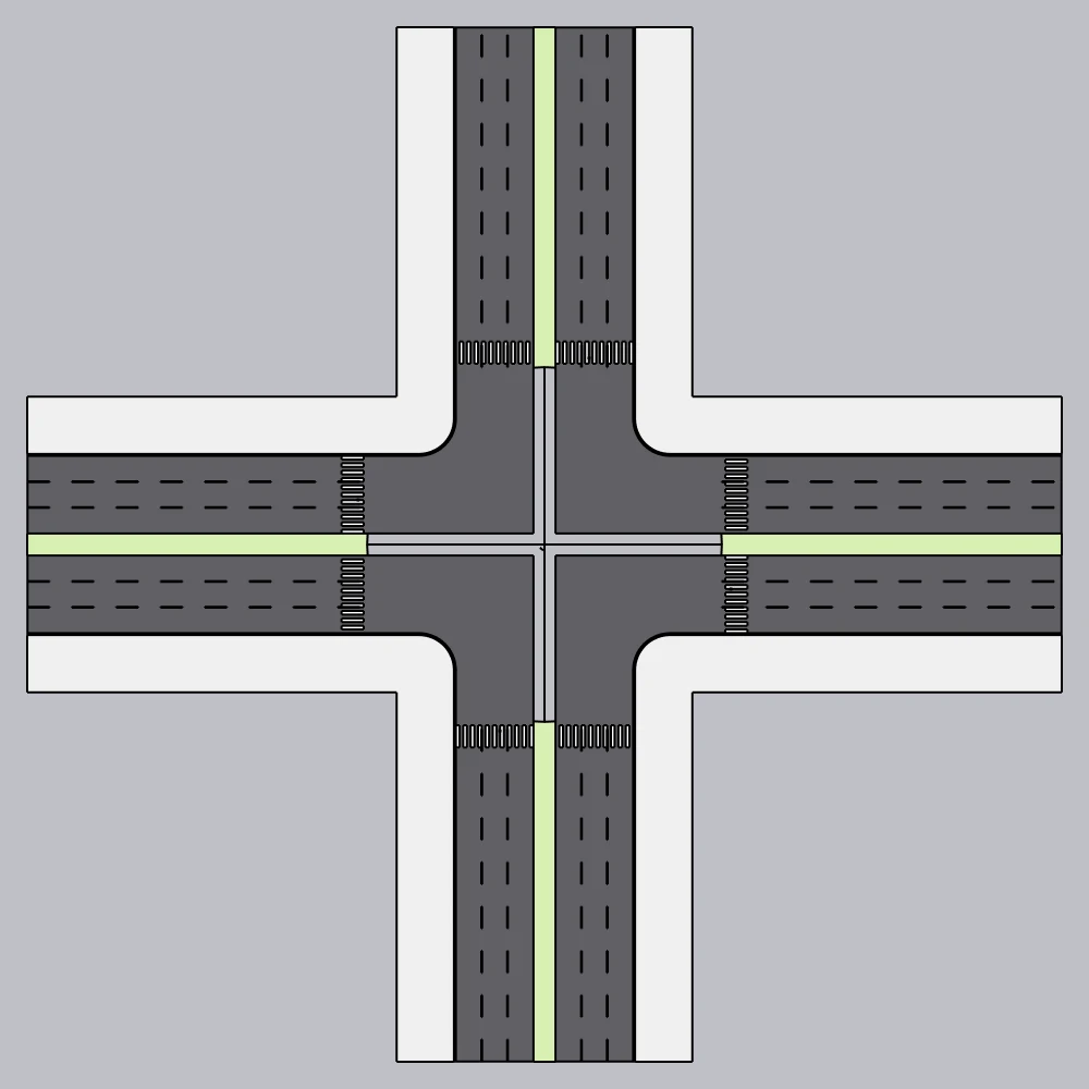
The centre line is derived from the section itself: one lane each way gives a broken white line, two or more gives the double solid yellow of marking 1.3, and a central median means no centre line at all. Stop lines follow marking 7.1 — a 40 cm solid bar set 60 cm back from the crossing.
Arrows are not placed by hand. Each approach works out where you can actually turn, from the bearings of the other arms at that junction, and emits an arrow per lane. A T-junction gets no arrow for a movement that does not exist.
Curb returns default to 6 m and widen automatically for wider roads, but every corner can be set individually. Crossings are included, and a central island when you need a roundabout.
Where eight lanes meet four or two, each band is interpolated by tag over a length derived from the carriageway-edge offset, using a smooth curve so the edge has no kink. A band present on one side only closes to its own inner edge.
Elevation is sampled by ray-casting onto your own terrain mesh on a 128×128 grid, the centre line is densified every 2 m, smoothed and grade-clamped. Surfaces and markings are draped onto that profile, embankments run down to the toe, and the corridor ground is patched separately so the original terrain is never edited.
They are spaced along the sidewalk edge rather than projected sideways from the centre line, so the row does not break where the sidewalk curves into a junction — and it clears the junction automatically.
Any band that had to be dropped or routed around is recorded and returned with the result. Losing a patch of carriageway silently is very hard to spot in a large network.
GIS brings in what exists: real roads at OSM widths, used as context. Lotuz Road is a design tool — you draw the alignment and it builds the carriageway to a chosen section, with junctions, markings and terrain following. They share a model, but each plugin is bought separately.
Yes. Centre lines, stop lines and directional arrows follow QCVN 41:2019/BGTVT, down to details like the 40 cm stop bar set 60 cm back from the crossing.
It does. Elevation comes from the terrain mesh already in your model, the profile is smoothed and grade-clamped, and embankments run down to the toe. The original terrain is not modified — the patch is displayed under the road group.
No. Edit mode changes a corner radius, an alignment’s road type or a node position, and only the affected part is rebuilt. Hide the built geometry when you want to see the bare alignment.
Yes — it is ordinary SketchUp geometry, so Lotuz Sync pushes it across like anything else. Sync is a separate plugin, bought on its own.
Lotuz Road is bought separately, by the year, and ships in the same installer as GIS, Sync and the Dashboard. Install it and sign in with the account you bought Road on.
Each plugin is bought separately, by the year. Sign in with the account you bought it on to unlock it.
Hands-on tutorials written by the Lotuz team for architects and visualizers — free to read, no account needed. (In Vietnamese.)
Courses:SketchUpCorona · 3ds MaxD5 RenderBlenderBrowse the whole Community →
AI for Photoshop
Generate, relight and upscale with AI without leaving your open document. 17 models, 118 architecture prompts.
Learn more →Render and edit architectural images on the web
Upload a SketchUp view, pick a preset and press Render — the result keeps your massing and camera. Not happy with one spot? Mark it to change, add or remove, and nothing else moves.
Learn more →SketchUp to 3ds Max sync
Native geometry transfer between apps — no FBX, no axis flips, no broken texture paths.
Learn more →SketchUp to Blender — early build
Live link from SketchUp to Blender, carrying materials, camera and sun direction. Install the add-on for Blender 4.2 or newer and enable it in Preferences › Add-ons. Early build, still being finished.
Learn more →Urban context and terrain inside SketchUp
Frame an area on the map and get building blocks, roads at real widths, green areas and terrain — each layer on its own tag.
Learn more →Lay curbs and edging along a path
Pick a profile and run it along a path: curbs, planter edging, gutters. A library of ready-made profiles is included.
Learn more →Parametric doors, windows and curtain walls
Build doors, windows and curtain walls from parameters inside SketchUp, in the Doors / Curtain wall tab of the Lotuz Dashboard.
Learn more →Clean up SketchUp files — free
Eleven controlled cleaning commands, each undoable on its own. Find the heavy objects, merge duplicates without changing shapes, then write a compacted copy.
Learn more →SKP · SKM · texture library
Browse models, materials and textures in one window. Thumbnails are packed into the folder itself, so the whole studio shares them.
Learn more →Massing and apartment layout — free
Block out a building, split a typical floor into apartments and read planning figures right inside SketchUp. Free, no expiry.
Learn more →Block · Remove · Manage · Add SketchUp plugins
One place to control extensions: toggle, block conflicts, uninstall broken plugins, install more, and review hotfixes — free with Lotuz.
Learn more →Use Claude with SketchUp
Let Claude or Codex drive SketchUp over the MCP protocol. Still being finished, opening soon.
Learn more →